Forget the Capital
A private inn in the Dakigaeri Valley. All rooms have an open-air bath.
Tazawako area
#Hot springs and accommodation
Search Results 357items
A private inn in the Dakigaeri Valley. All rooms have an open-air bath.
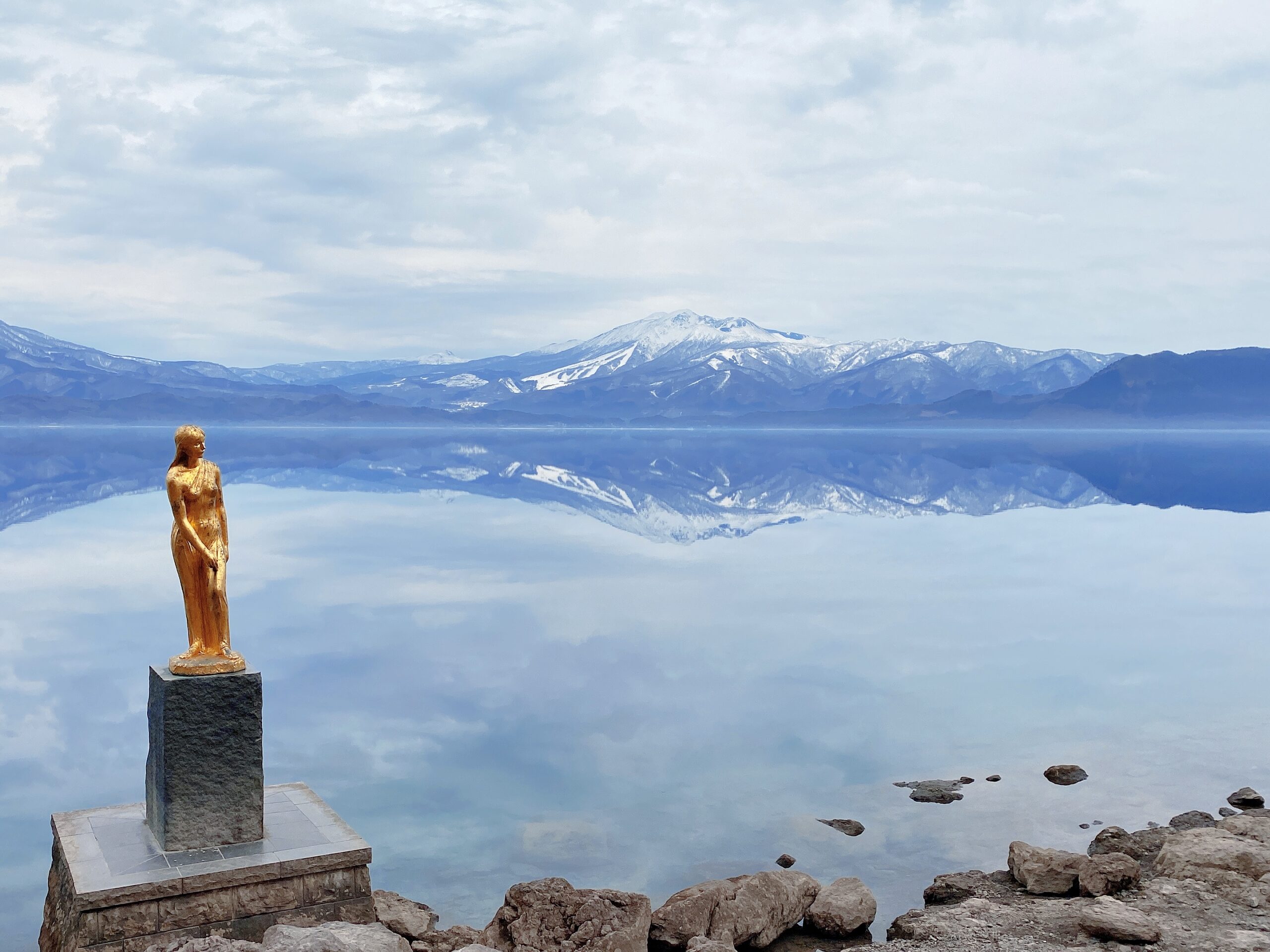
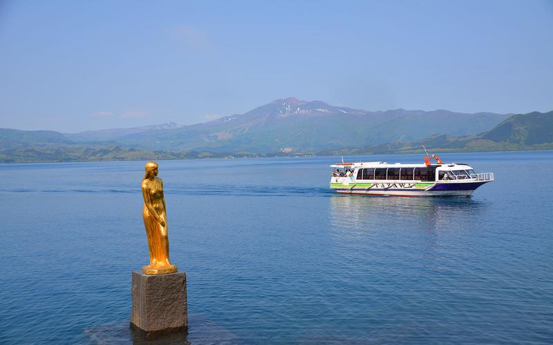
TazawakoTazawako, with its deep blue surface and the legend of Princess Tatsuko, is an almost circular lake with a circumference of about 20 kilometer
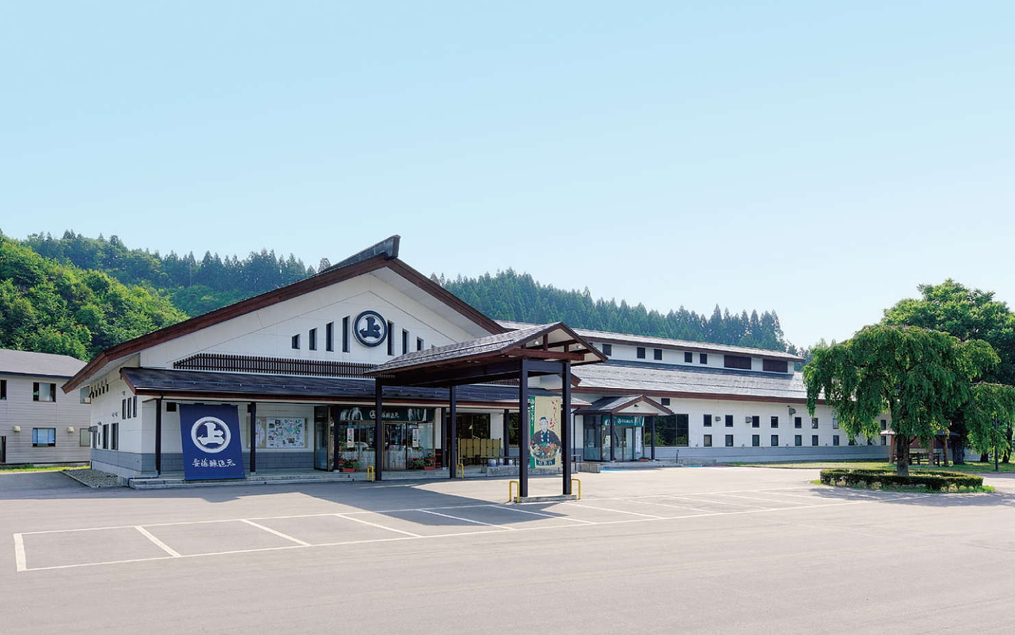
Kitaura Main Store, located on the old National Route 46 closer to Akita City than Kakunodate, opened in the fall of 1996, stocking all of our product
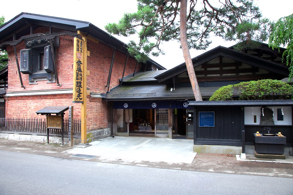
We quietly cultivate traditional flavors that have transcended time. Our shop was founded over 170 years ago in Kakunodate, a historic town overflowin
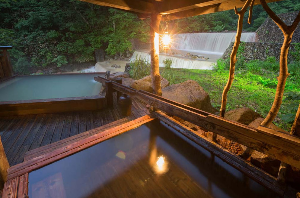
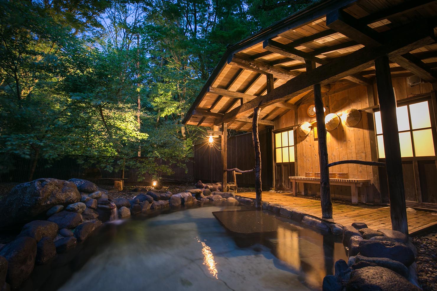
A lodging along a mountain stream with two hot springs. Popular with female guests.
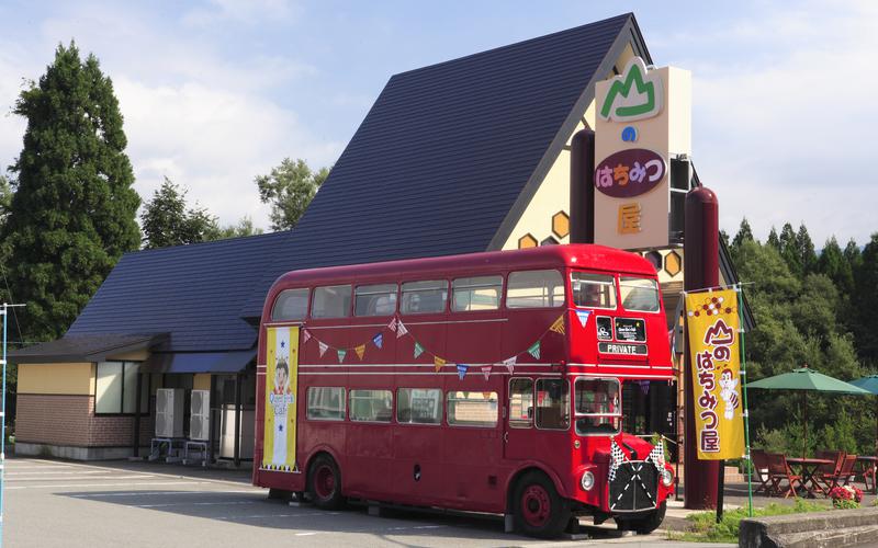
They are engaged in beekeeping in their local Lake Tazawa area, and are popular for their domestic honey, honey from around the world, processed honey
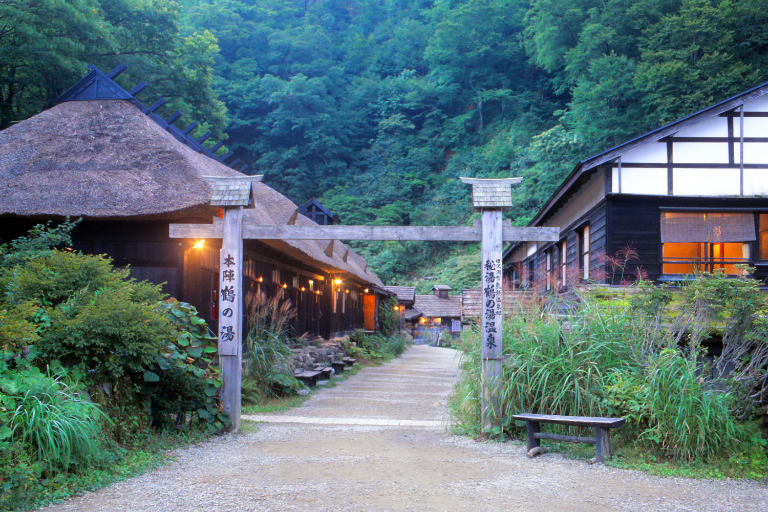
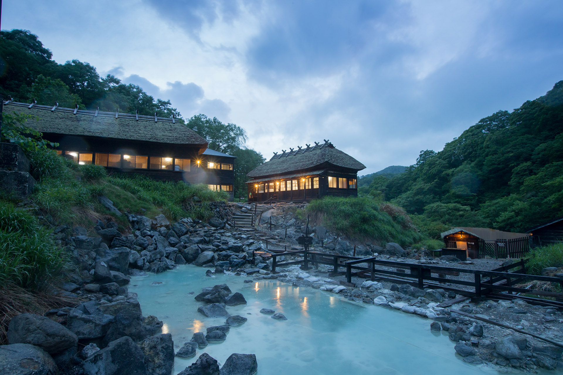
Tsurunoyu Onsen is one of the eight inns in the Nyuto-Onsenkyo at the foot of Mt.nyuto (1,478m), and is the oldest hot spring inn in the area. It is s
TazawakoTazawako, with its deep blue surface and the legend of Princess Tatsuko, is an almost circular lake with a circumference of about 20 kilometer
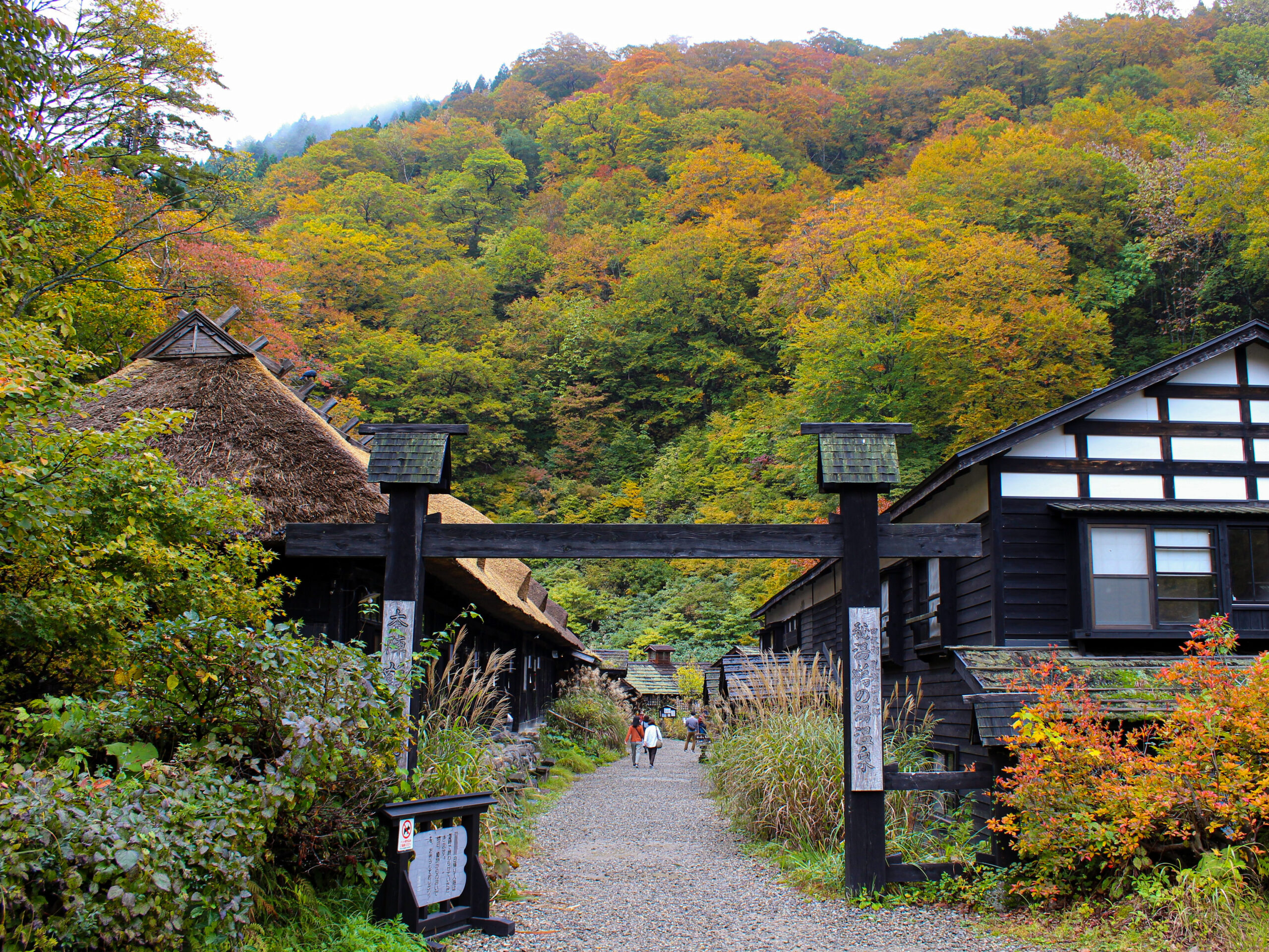
It is no exaggeration to say that it is the most famous hidden hot spring in Japan. The seven hot springs, which retain the atmosphere of a therapeuti
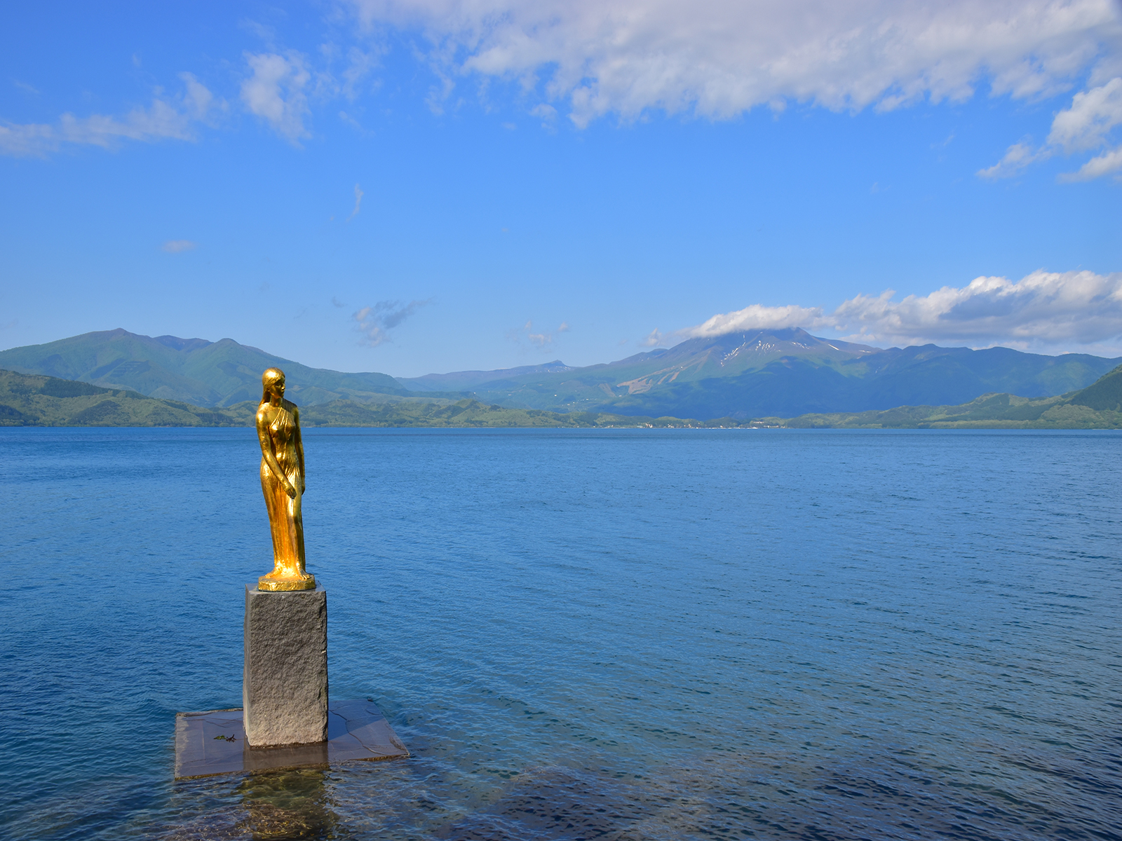
This bronze statue of the legendary beautiful Princess Tatsuko, who is said to have wished for eternal youth and beauty and became the lake goddess, s
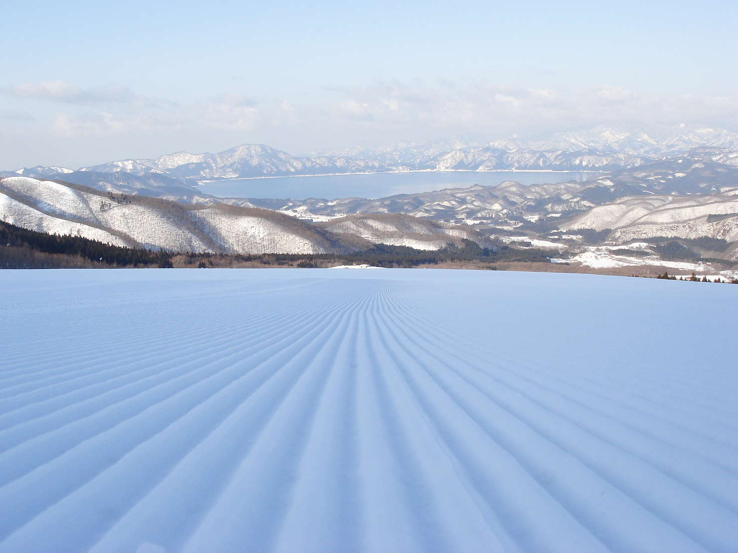
[Experience reservations available]With views of the mountains and lake, you can enjoy a series of spectacular downhill runs on the big slopes. There
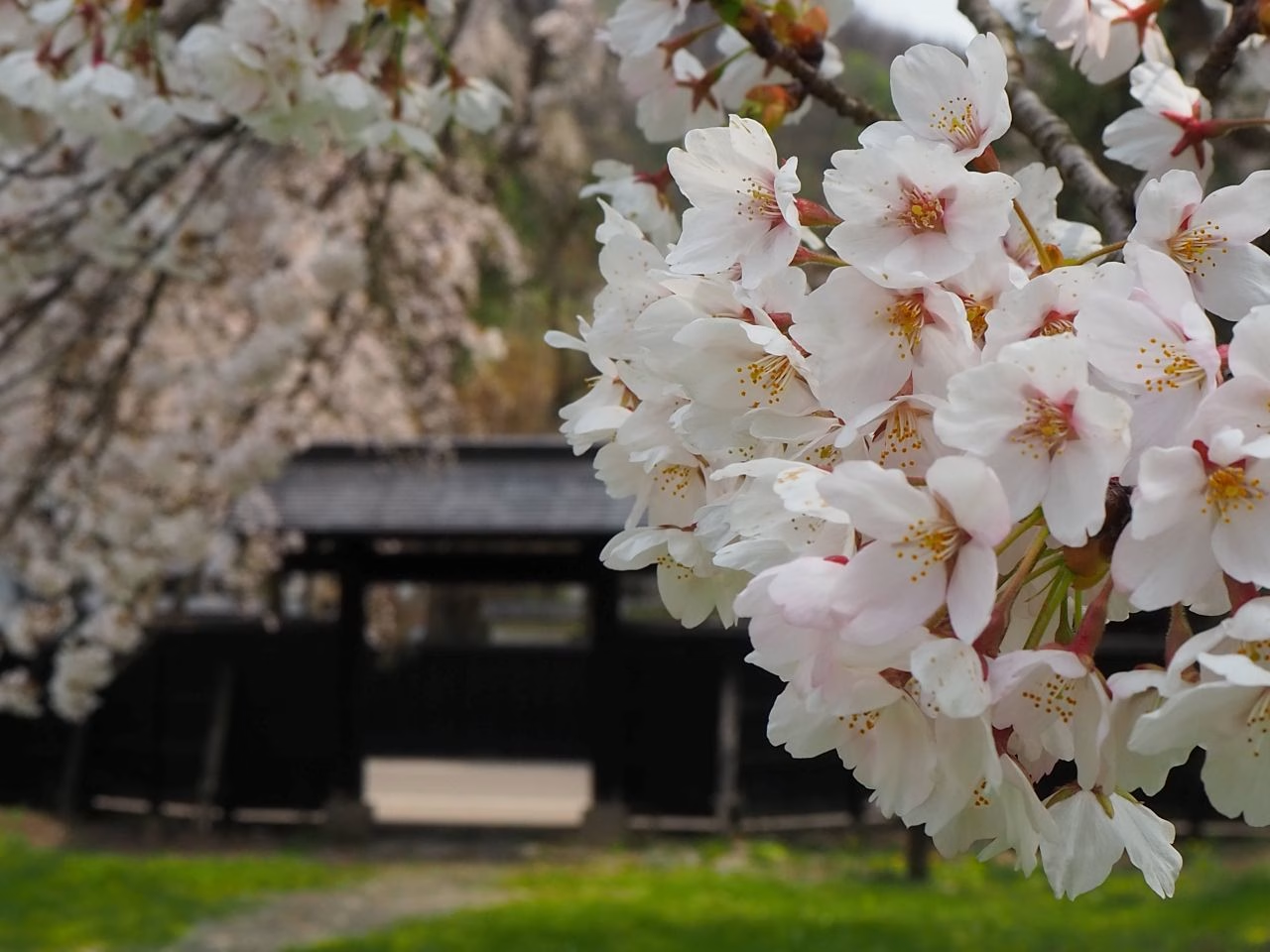
The castle town of Kakunodate is overflowing with cherry blossoms.
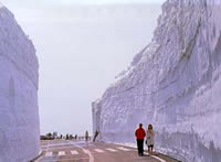
The road opens in late April. For around 20 days, a snow corridor will continue on both sides of the road. This scenery is created when snow is remove
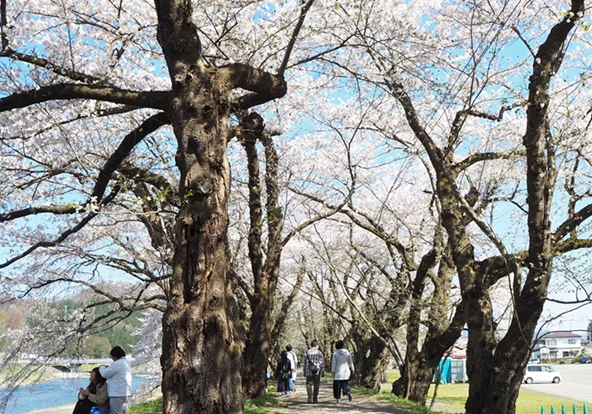
The Somei Yoshino cherry trees along the Hinokinai River embankment (designated as a national scenic spot) form a tunnel of cherry blossoms stretching
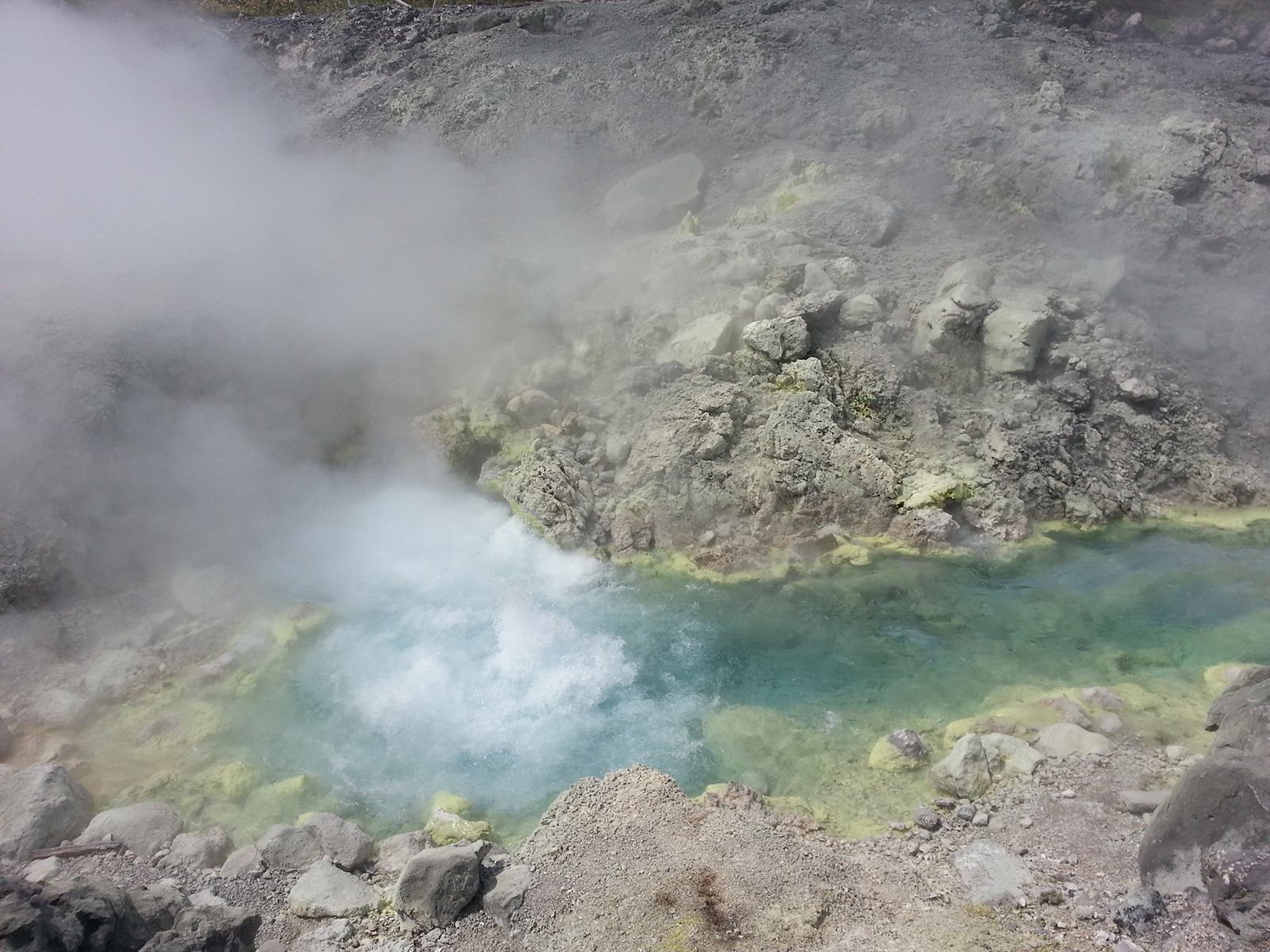
The source is a strongly acidic spring with a flow rate of 9,000 liters per minute, a temperature of 98 degrees, and a pH of 1.1, flowing in a 3-meter
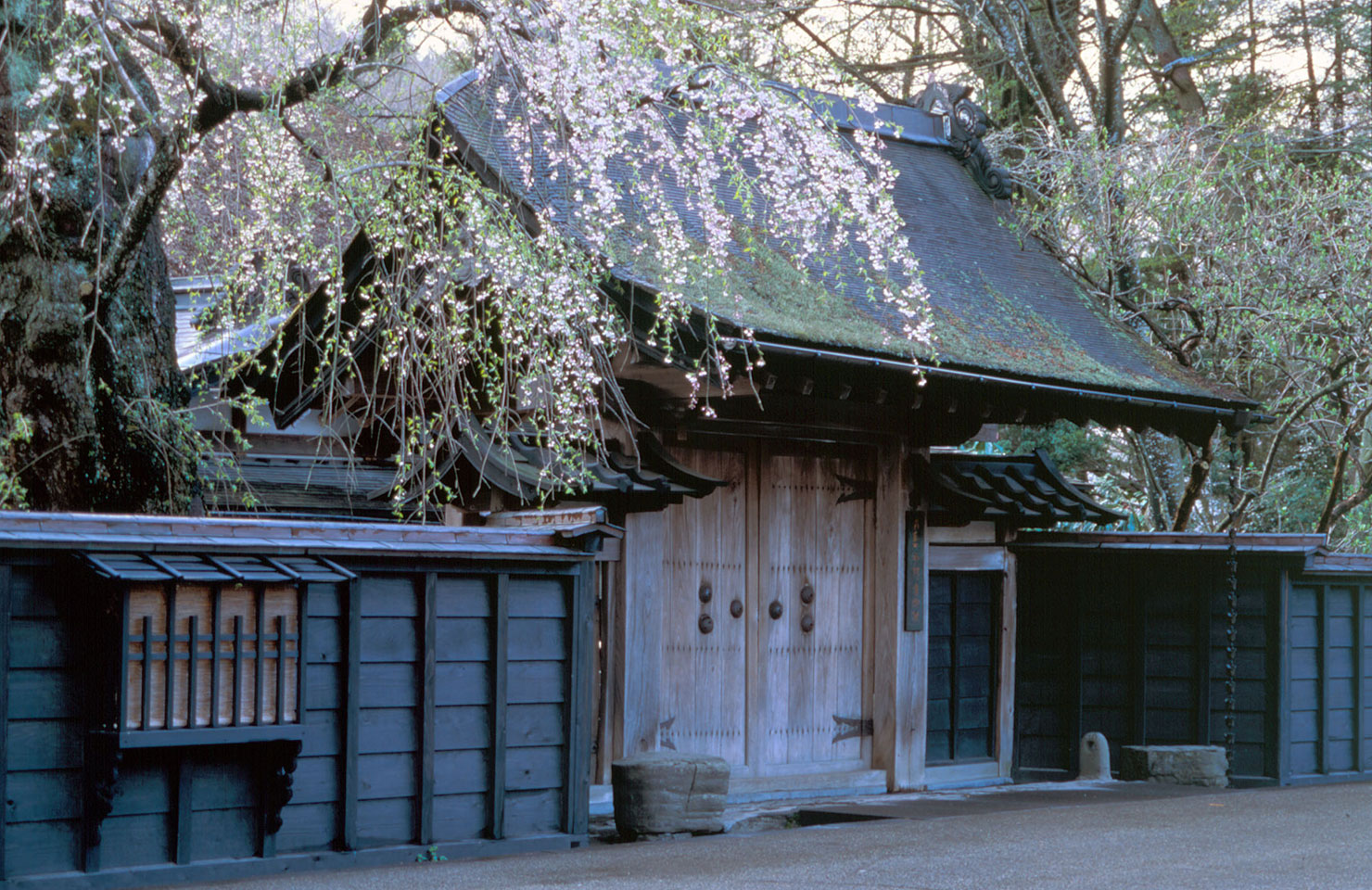
The Aoyagi family samurai residence tells the story of 400 years of history in the Michinoku region. Within its 3,000-tsubo (approximately 10,000 squa
Located at the very back of the Nyuto-Onsenkyo, the hotel has two large hot springs on its premises, and produces the largest amount of milky white wa
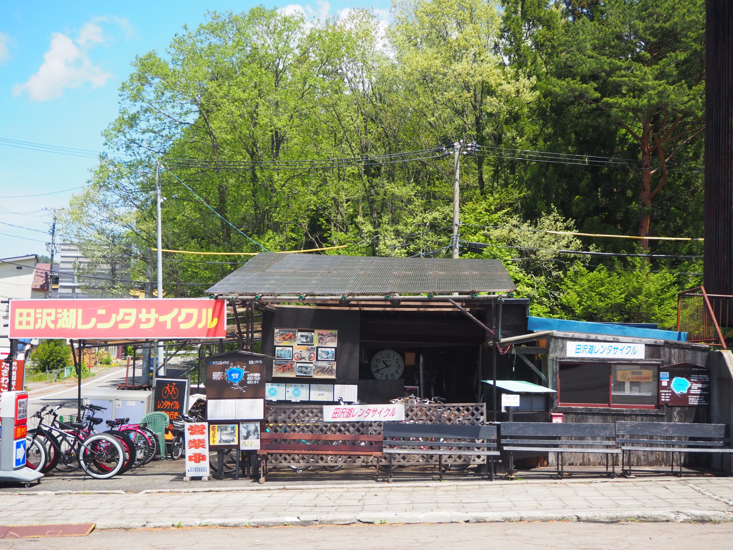
Travel around while feeling the breeze on your skinTazawako, the deepest lake in Japan, is about 20km in circumference and can be cycled in about 1 to
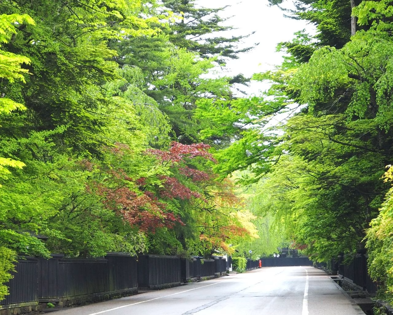
Traces of the castle town still remain It was the Ashina clan who created the townscape of Kakunodate that continues to this day in 1620 (Genwa 6), at
A lodging along a mountain stream with two hot springs. Popular with female guests.
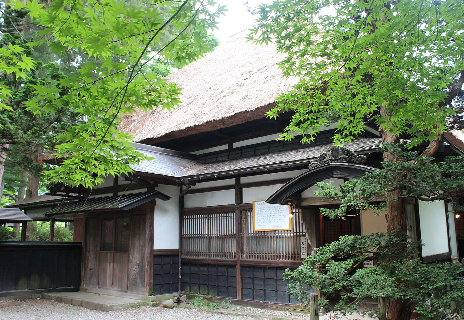
Of all the samurai residences in Kakunodate, Akita, this is the only one where direct descendants continue to live in the main house. Because it conti
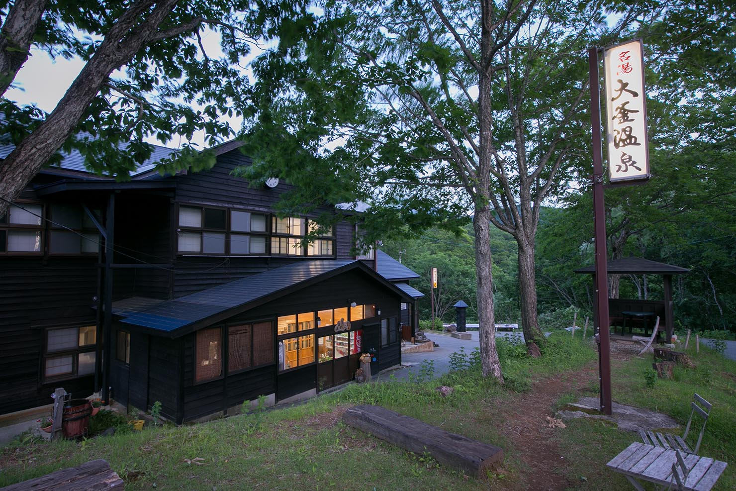
Ogama Onsen has an open-air bath that can be used even in winter, and is popular with hikers and skiers. Open all year round. Spring quality : arsenic
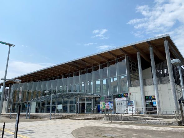
Tazawako Tourist Information Center Folake is an information center located inside JR Tazawako Station. We are here to help you with your trip. We are
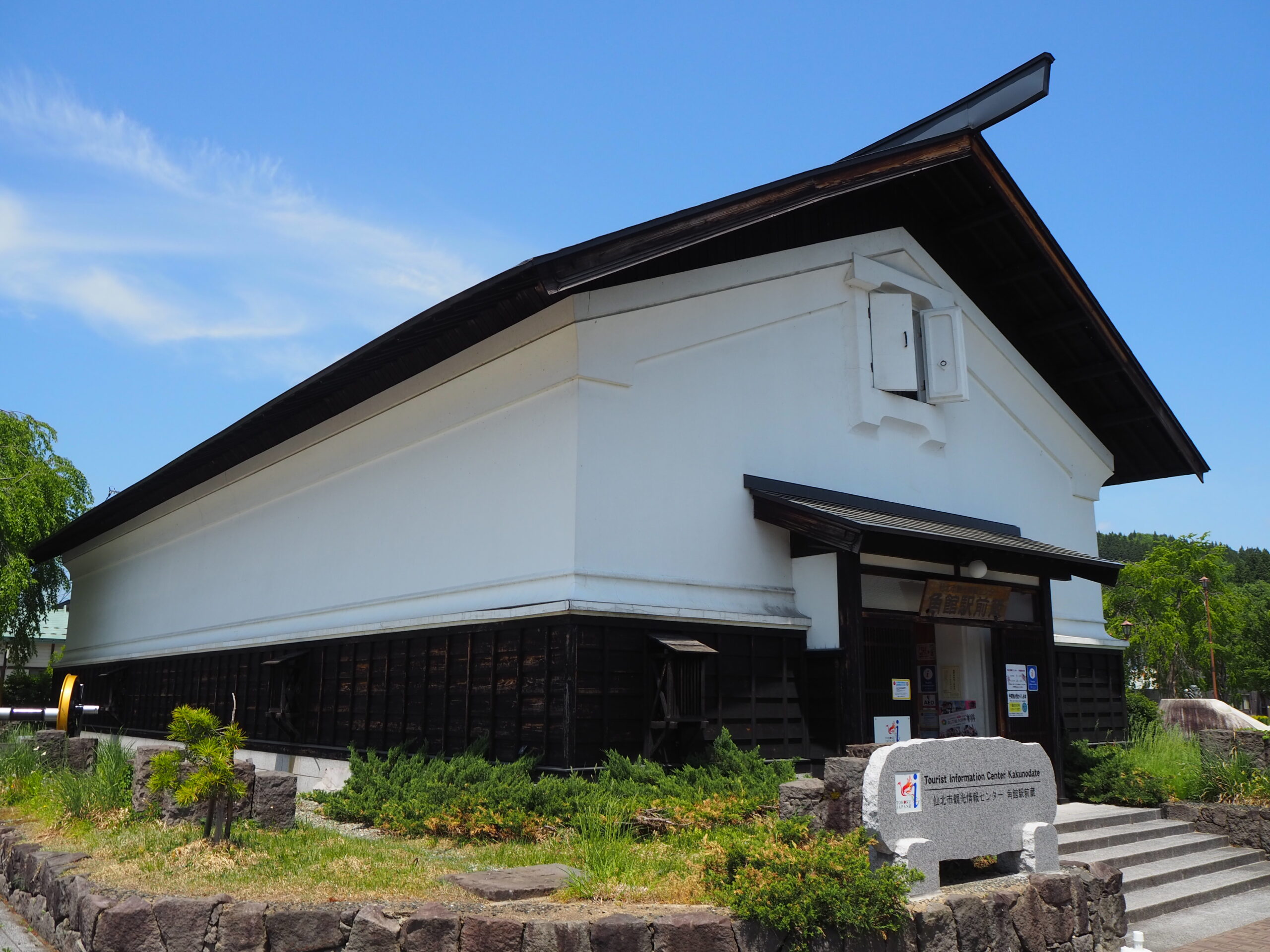
This large storehouse-style tourist information center is located in front of JR Kakunodate Station. It is the white-walled building on the right side
We quietly cultivate traditional flavors that have transcended time. Our shop was founded over 170 years ago in Kakunodate, a historic town overflowin
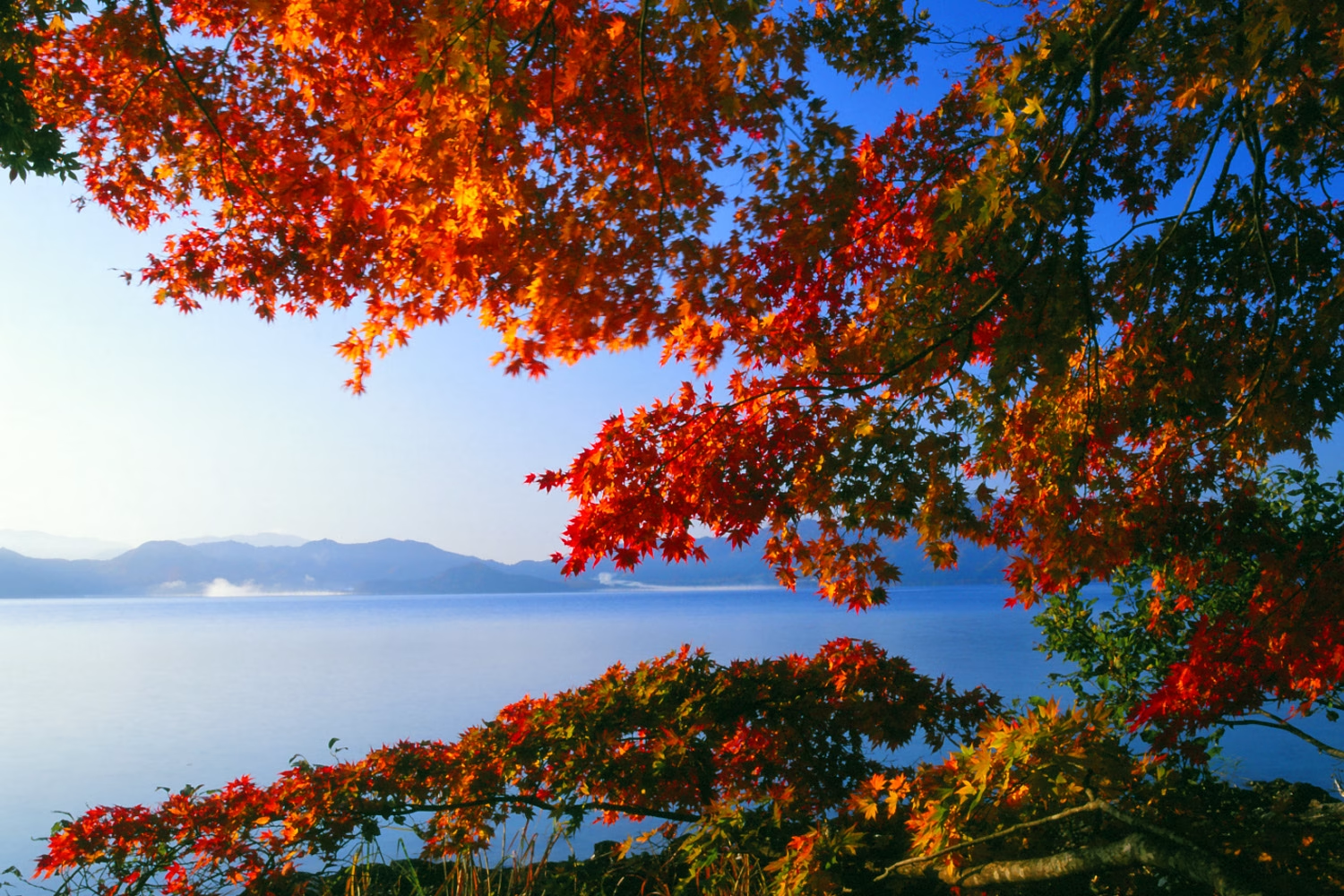
仙北市の紅葉は秋田駒ケ岳から始まり、乳頭温泉郷、田沢湖高原温泉郷、水沢温泉郷、玉川温泉周辺、そして田沢湖へ。 さらに抱返り渓谷、角館へと移りゆきます。
1 minute walk from Kakunodate station1 minute walk from Kakunodate station! In front of the tourist information center Ekimae Kura! It is used by many
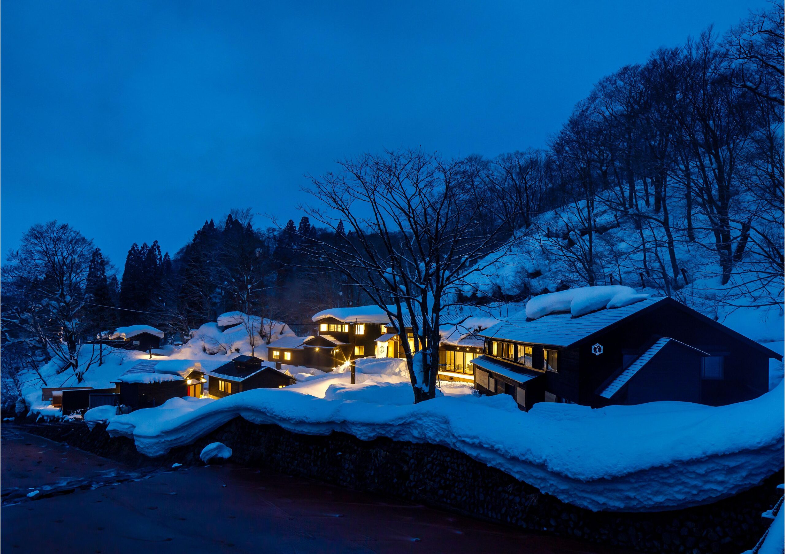
A warm-hearted inn surrounded by clear streams and deep mountains. Also known as Mountain Medicinal Baths, it is characterized by having separate acco
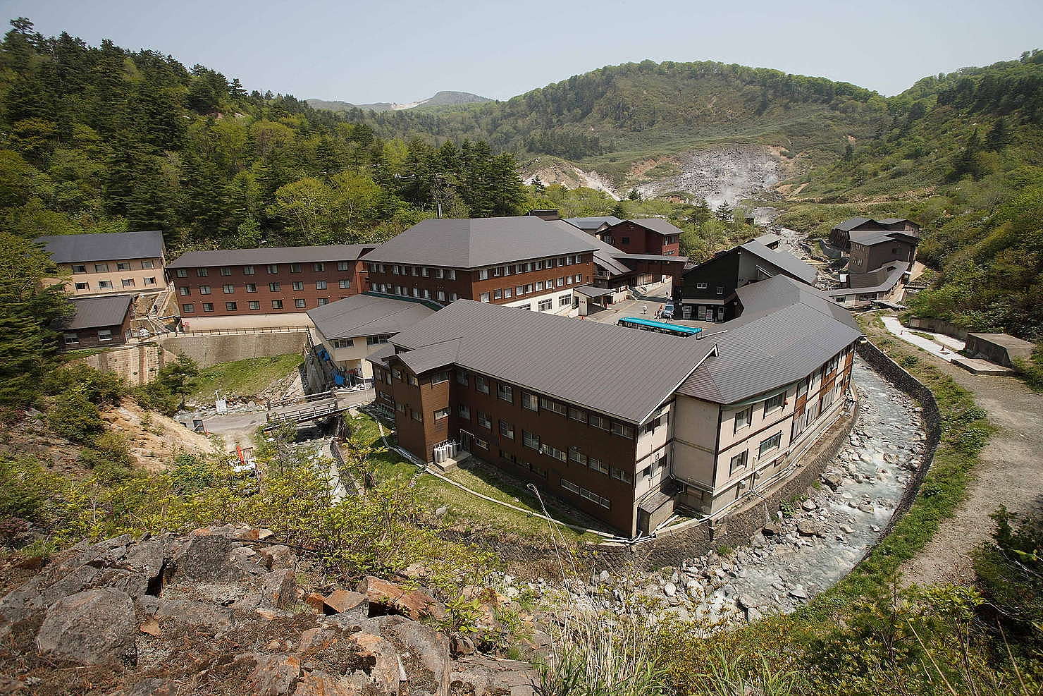
The adjacent natural bedrock bath is said to be the birthplace of bedrock bathing, and its highly acidic spring water, said to be the best in Japan, i